More heat advisories for south Alabama on Tuesday
Another day of sweltering heat is in the forecast for south Alabama on Tuesday, and heat advisories will be in effect across the region.
The National Weather Service is forecasting highs to reach the mid- to upper 90s again across south Alabama, and those temperatures combined with high dewpoints could make it feel much hotter.
Those in north Alabama will get a break of sorts, with highs expected to “only” reach the 80s on Tuesday, according to forecasters.
More of that slightly cooler air will filter southward on Wednesday to affect more of the state.
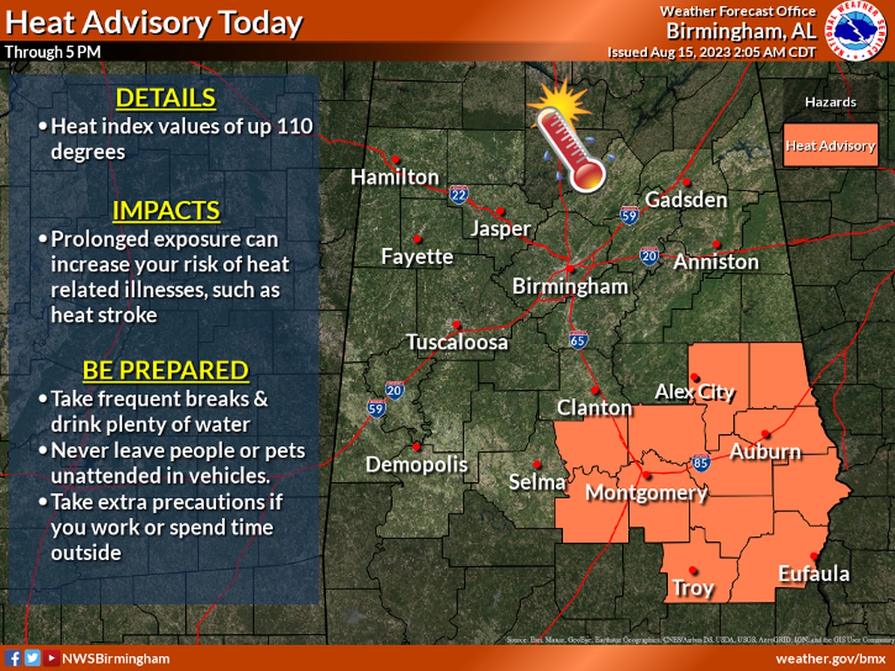
Here’s a look at the heat advisories in effect for Alabama on Tuesday:
CENTRAL ALABAMA
Heat advisories will be in effect for part of central Alabama on Tuesday.
* Heat advisory until 5 p.m. Tuesday for Tallapoosa, Chambers, Autauga, Lowndes, Elmore, Montgomery, Macon, Bullock, Lee, Russell, Pike and Barbour counties.
The National Weather Service said heat index values up to 110 degrees will be possible.
SOUTH ALABAMA
* Heat advisory from 10 a.m. until 7 p.m. Tuesday for Washington, Clarke, Monroe, Conecuh, Butler, Crenshaw, Escambia, Covington, Mobile and Baldwin counties.
The weather service said heat index values up to 110 are expected.
* Heat advisory from 10 a.m. until 6 p.m. CDT Tuesday for Coffee, Dale, Geneva, Henry and Houston counties.
The weather service said heat index values up to 112 are expected.