Where is the most likely spot for severe weather today?
More severe storms are in the forecast for part of Alabama on Saturday.
NOAA’s Storm Prediction Center is forecasting a Level 2 out of 5 (or slight) risk for severe weather for roughly the northern third of Alabama today.
A Level 2 risk means that scattered severe storms will be possible.
Other areas in central Alabama have a Level 1 risk today and could have to deal with isolated severe storms.
Rain and storms will also be possible across south Alabama, but widespread severe storms aren’t expected.
The tornado risk is low to zero today, but the strongest storms could bring damaging wind gusts, hail and heavy rain that could lead to isolated flooding.
In addition to the storms there will be dangerous heat levels across nearly all of Alabama on Saturday, and heat warnings and advisories are in effect.
The National Weather Service said storms will be possible starting as soon as 11 a.m. and could last into the nighttime hours.
The Storm Prediction Center has issued a severe thunderstorm watch for north and parts of central Alabama that will be in effect until 6 p.m. Saturday:
Forecasters said a “thunderstorm cluster will continue to intensify across the Tennessee Valley into the afternoon as it moves east to east-southeast across the watch area. The stronger storms will be capable of a threat for damaging gusts and perhaps isolated large hail.”
Wind gusts could be as high as 70 mph, and hail could be as big as 1.5 inches.
The Alabama counties in the severe thunderstorm watch are Blount, Calhoun, Cherokee, Clay, Cleburne, Colbert, Cullman, DeKalb, Etowah, Fayette, Franklin, Jackson, Jefferson, Lauderdale, Lawrence, Limestone, Madison, Marion, Marshall, Morgan, Randolph, Shelby, St. Clair, Talladega, Walker and Winston.
More storms are also expected to develop during the heat of the day and could intensify quickly and become severe, with straight-line winds the main concern.
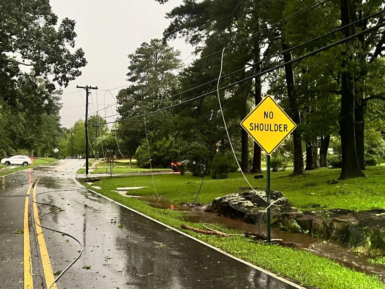
Those winds can easily take down trees and power lines, as seen in the Bluff Park area of Hoover on Friday:
Friday’s round of storms took out power lines in the Bluff Park area of Hoover. This was also the story in other parts of Alabama on Friday.
Here’s what the National Weather Service offices in Alabama were thinking about Saturday’s storm potential — and the timing:
NORTH ALABAMA
CENTRAL ALABAMA
SOUTHWEST ALABAMA
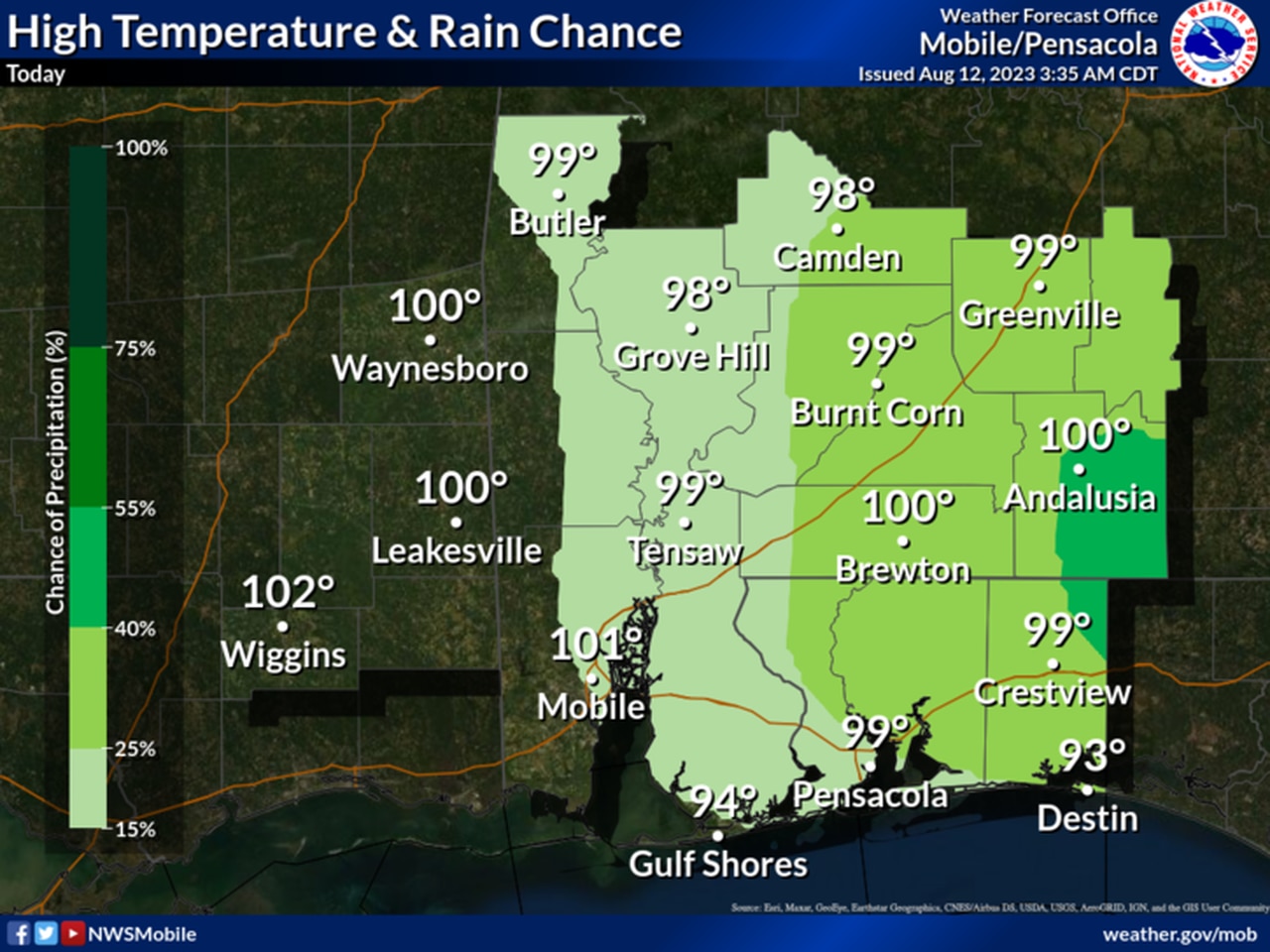
Here are rain chances expected today in southwest Alabama.
SOUTHEAST ALABAMA
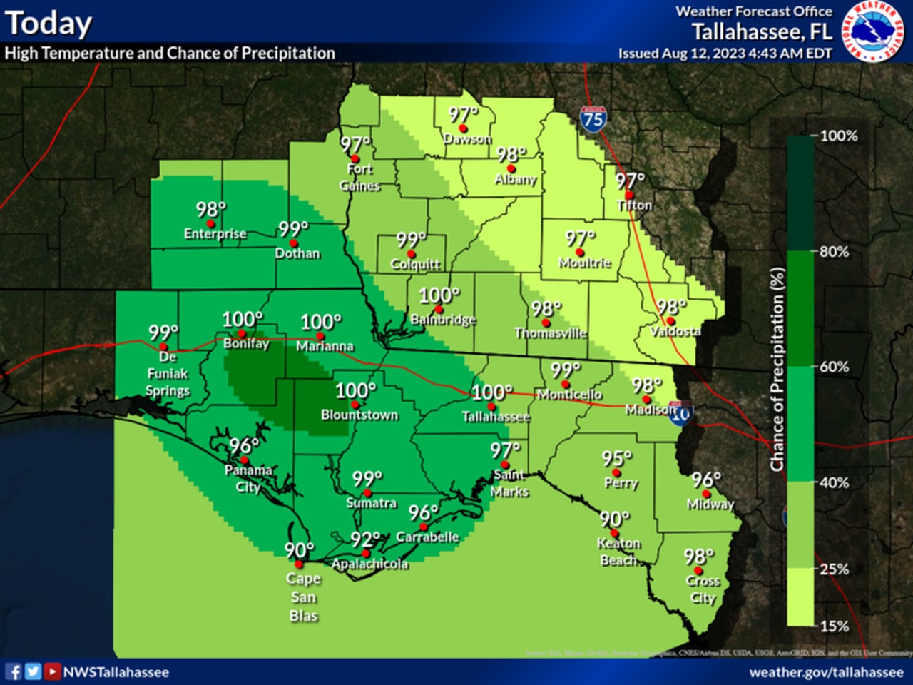
Here are the rain chances for southeast Alabama on Saturday.