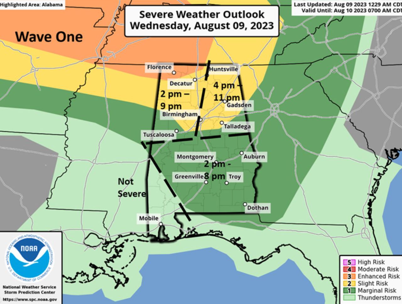
Two waves of severe weather possible in Alabama today: When will storms start where I live?
Two waves of storms are forecast for Alabama today with the greatest threat in areas near and north of I-20.
Jim Stefkovich, meteorologist, Alabama Emergency Management Agency, said a potent upper-level system will move across the region this afternoon and in the evening.
Afternoon storms in the northern part of the state could bring all forms of severe weather, including a couple of tornadoes. South of I-20, a few thunderstorms and a couple of damaging wind gusts are possible but will be isolated and parts of the region will remain dry.
Storms will enter the northwest to central part of the state from 2 p.m.-9 p.m. with part of the area in the far northeast, including Florence, in the enhanced risk area. The storms will move to the east to places like Huntsville and Gadsden down to Talladega from 4-11 p.m. The southern half of the state, including places like Montgomery, Auburn, Troy and Dothan, could see severe weather starting at 2 p.m.
Then, another line of storms will enter the northern sections of the state around midnight and move slowly southward during the night. A few damaging wind gusts are possible north of I-20 prior to 8 a.m. Thursday.
A few storms across the northern half of the state may produce a couple of damaging wind gusts Thursday afternoon into early evening, but widespread severe weather is not forecast.
