More severe storms Tuesday: What time will storms arrive where I live?
Alabama is bracing for another round of storms today with a stronger threat of severe weather for Wednesday.
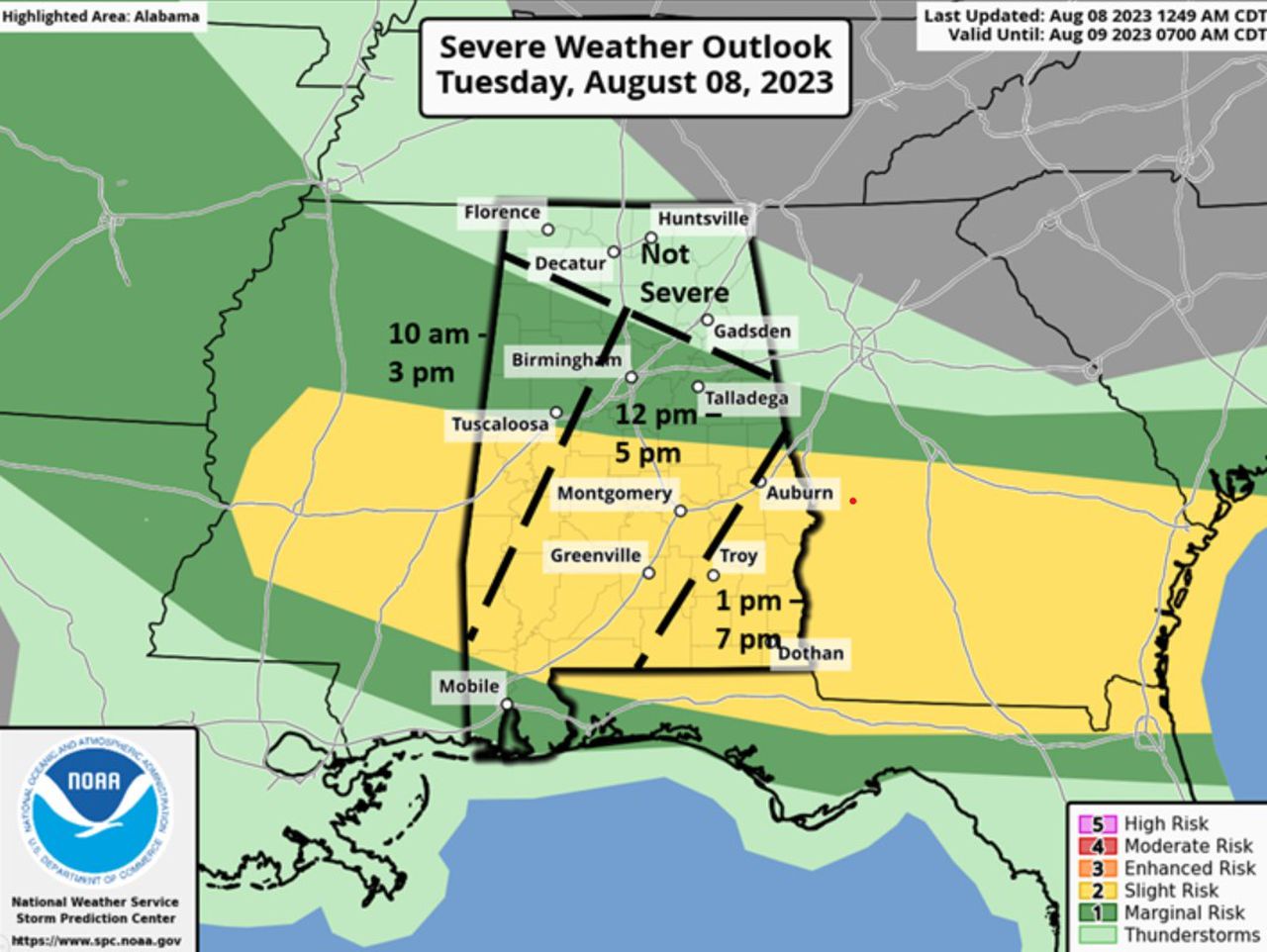
Jim Stefkovich, Meteorologist, Alabama Emergency Management Agency, said clusters of storms will enter the northwest portions of the state by late Tuesday morning and exit the southeastern sections by early evening. The storms could bring damaging wind gusts and hail.
Storms will enter the western part of the state from 10 a.m.-3 p.m. before pushing to the central part – including Birmingham and south past Montgomery – from noon – 5 p.m. Tuesday’s storms will exit the southwestern corner of the state from 1-7 p.m.
READ MORE: More storms? Here’s who may get the worst weather on Tuesday
On Wednesday, a Mesoscale Convective System, or MCS, is forecast to enter the western sections of the state late Wednesday morning and exit the eastern portions by late afternoon. The storms have the potential for strong winds and hail.
On Thursday, yet another MCS is currently forecast to move across the northern half of the state sometime from the morning hours through the afternoon with damaging wind gusts and hail possible.
The unsettled weather pattern will continue Friday into Saturday with scattered to numerous thunderstorms each day and the threat for a few damaging wind gusts.
