Storms, flooding and heat are concerns on Friday
Strong storms, flooding and dangerous heat will all be concerns in parts of Alabama on Friday, according to forecasters.
Flash flooding has been a big issue in parts of northern Alabama, where several flash flood warnings were issued on Friday morning.
The city of Oneonta in Blount County has been particularly hard-hit with flooding as of Friday morning, according to the National Weather Service:
Flood watches and heat advisories will be in effect in various areas through tonight. Areas that don’t get rain could see the heat index climb as high as 111 degrees this afternoon. Areas that get repeated storms could see up to 3 inches of rain.
There could also be a few severe storms in the mix.
NOAA’s Storm Prediction Center is forecasting a Level 1 out of 5 risk for severe weather today for parts of Alabama today. A Level 1 risk means isolated severe storms will be possible.
The strongest storms could have damaging winds and heavy rain. Storms were moving across parts of the state on Friday morning and could intensify as heat levels rise today.
HEAT CONCERNS TODAY
Speaking of heat, areas in west and south Alabama could see heat index values of 111 degrees this afternoon, and heat advisories will be in effect.
Here’s a look at Friday’s heat advisories:
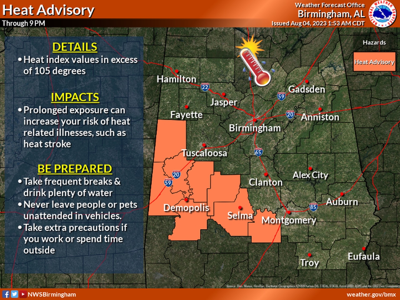
CENTRAL ALABAMA
A heat advisory will be in effect on Friday for the counties in orange.
* A heat advisory will be in effect until 9 p.m. Friday for Sumter, Greene, Hale, Perry, Marengo, Dallas, Pickens and Lowndes counties. Heat index values up to 108 will be possible.
SOUTH ALABAMA
* A heat advisory will be in effect from 11 a.m. until 7 p.m. Friday and from noon until 7 p.m. Saturday for Choctaw, Washington, Escambia, Mobile and Baldwin counties. Heat index values up to 111 will be possible.
* A heat advisory will be in effect from 11 a.m. until 7 p.m. Friday for Clarke, Wilcox, Monroe, Conecuh, Butler, Crenshaw and Covington counties. Heat index values up to 109 are expected.
FLOODING CONCERNS
Flooding will also be a concern for areas farther north in Alabama.
The National Weather Service has several flood watches in effect for north and central Alabama. Some areas could get up to 3 inches of rain before it’s over.
Here’s a look at the flood watches for Alabama:
NORTH ALABAMA
* A flood watch will be in effect until 1 p.m. Friday for Colbert, Cullman, DeKalb, Franklin, Jackson, Lauderdale, Lawrence, Limestone, Madison, Marshall and Morgan counties.
The weather service in Huntsville said heavy rain is expected through the morning, and areas getting repeated storms “will be highly susceptible to flooding.”
Forecasters said the flooding threat is expected to diminish this afternoon.
CENTRAL ALABAMA
* A flood watch will be in effect until 4 p.m. Friday for Blount, Calhoun, Cherokee, Clay, Cleburne, Etowah, Jefferson, Randolph, Shelby, St. Clair, Talladega, Walker, Winston, Autauga, Bibb, Chambers, Chilton, Coosa, Elmore, Fayette, Lamar, Lee, Macon, Marion, Russell, Tallapoosa and Tuscaloosa counties.
The weather service in Birmingham said multiple rounds of showers and thunderstorms will be possible through the afternoon and an additional 1 to 3 inches of rain could cause flash flooding.