Smoke and storms possible Tuesday in parts of Alabama
Alabama will have to deal with more smoke and a few storms on Tuesday.
NOAA’s Storm Prediction Center has added a Level 2 out of 5 risk for severe weather for the northern part of the state today and a Level 1 risk for areas southward into central Alabama.
A Level 2 risk means scattered severe storms will be possible; a Level 1 risk means isolated severe storms are possible. The strongest of those could have damaging winds and heavy rain.
In addition to the storms there will be continued haze over parts of the state from smoke. The smoke is from wildfires in Canada and has shifted southward over the past few days.
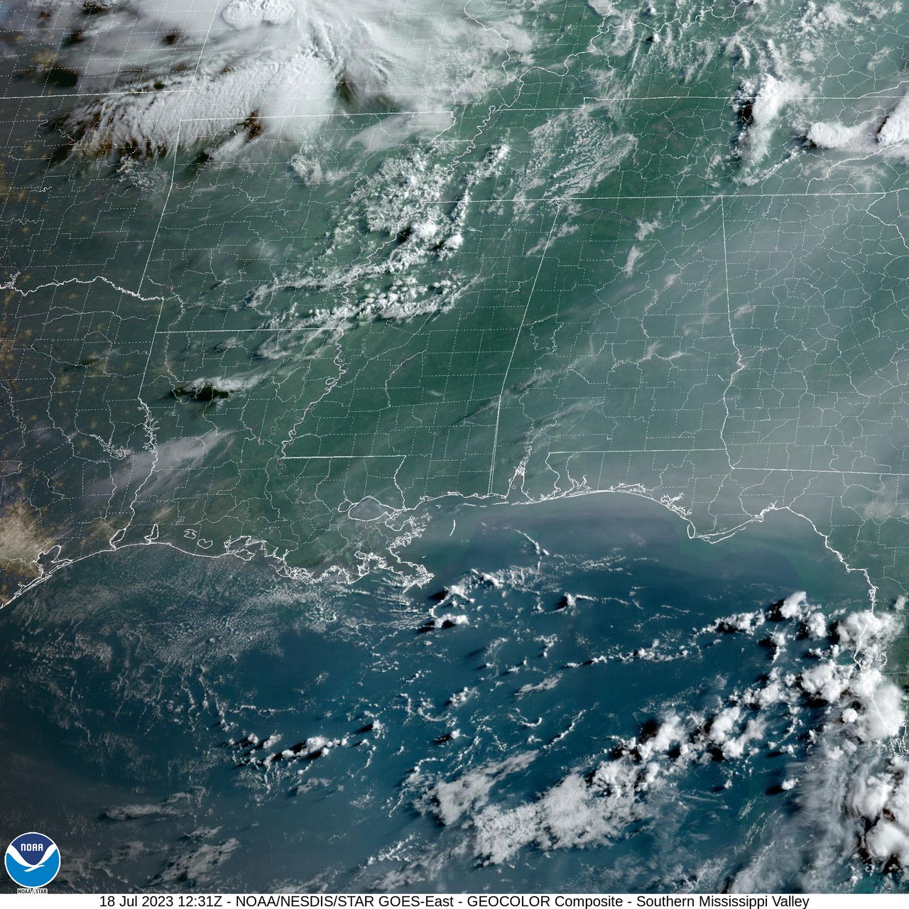
Here’s a look at the satellite image of smoke over part of the state as of Tuesday morning:
Smoke from Canadian wildfires was still visible over parts of Alabama on Tuesday morning.
The smoke is being pulled southward over the state thanks to an area of high pressure. Air moves clockwise around that high pressure system, and since Alabama is on the eastern edge of the “bubble,” air is pulled down from the north and west, which is why the smoke has been an issue the past few days.
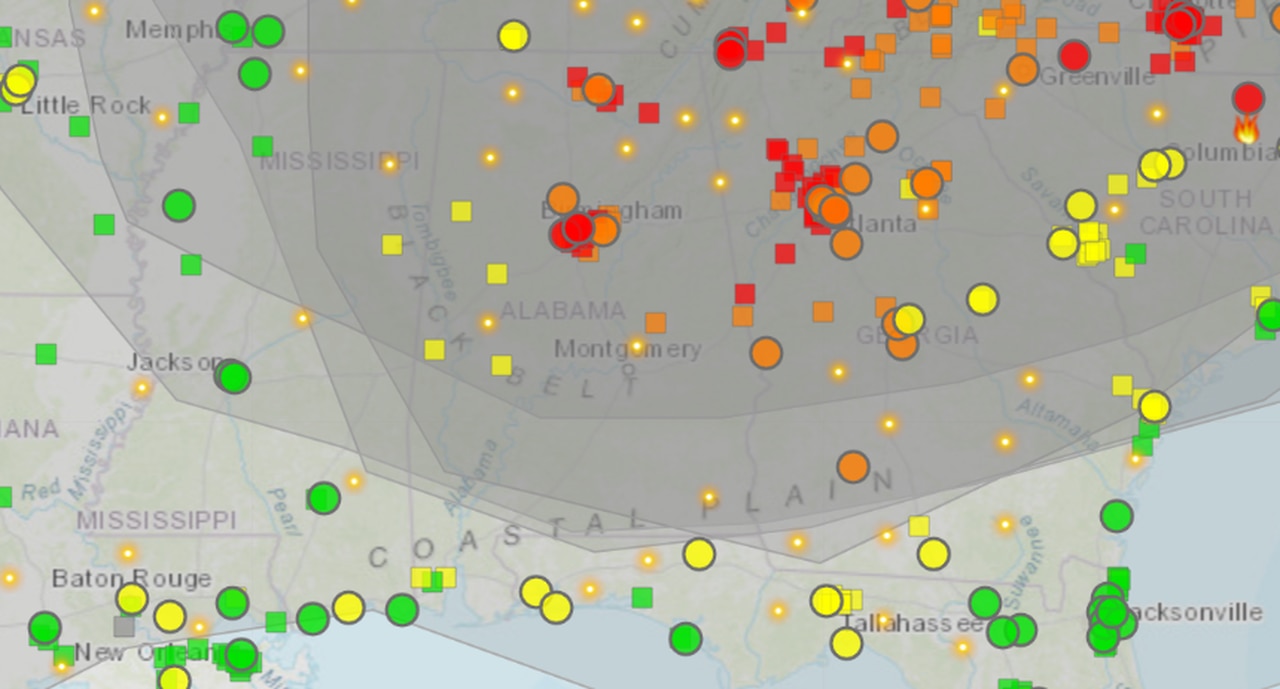
This map shows smoke levels in the air over Alabama as of Tuesday morning. The areas in red have higher concentrations of ozone and particulate matter, and an air quality alert will be in effect today for Madison and Morgan counties.
An air quality alert will be in effect today for Madison and Morgan counties in north Alabama in part because of the haze.
That northwest flow around the area of high pressure could also help to pull a complex of storms into the region, although when and where is still on the uncertain side. However, the timing looks to be more late afternoon into the nighttime hours.
The National Weather Service said some models show the storm complex, or MCS (mesoscale convective system), making it into Alabama, while others show it missing the state.
If storms do manage to make it into Alabama they could be intense, with damaging straight-line winds possible.
More isolated severe storms will be possible on Thursday as well in Alabama. Here is the severe weather outlook for Thursday:
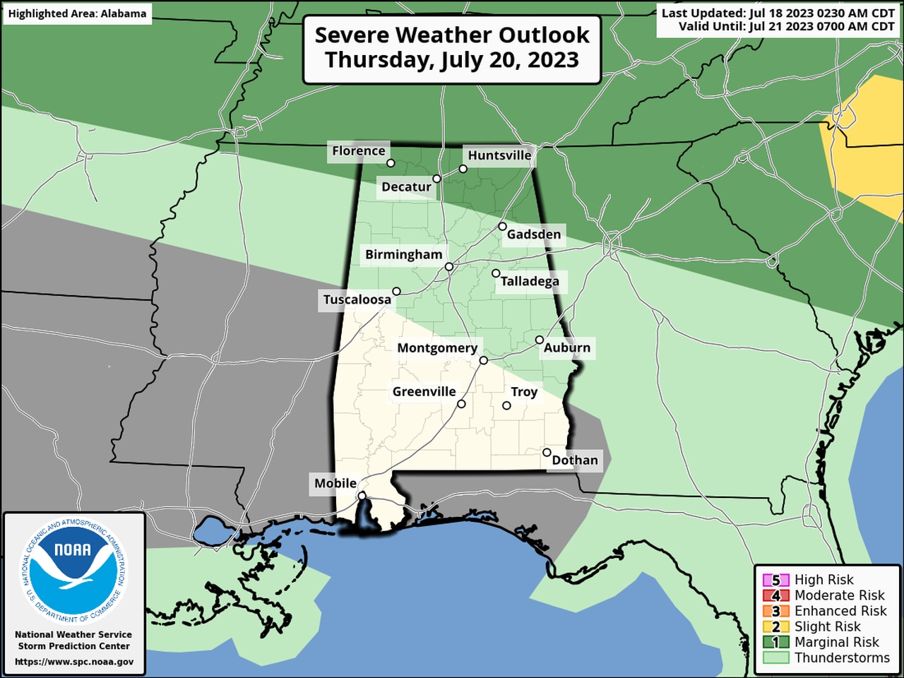
More isolated severe storms will be possible in extreme north Alabama on Thursday.
In addition, heat levels may make more heat advisories necessary for western parts of the state, according to the weather service.
A heat advisory will be in effect today from 11 a.m. until 7 p.m. for Mobile, Baldwin, Choctaw and Washington counties in southwest Alabama. Heat index values could reach as high as 110 today in those areas, according to forecasters.
Look for more heat advisories in the coming days for more of the state.