Severe weather possible today, tomorrow and Monday
Strong to severe storms will be possible in Alabama today, Sunday and Monday.
Sunday could be the most active day, with a large part of the state included in a Level 2 out of 5 risk for severe weather.
The strongest storms on all three days could have winds capable of taking down trees and power lines as well as hail and heavy rain. The tornado risk is low.
For today, NOAA’s Storm Prediction center has small parts of west Alabama in a Level 2 out of 5 risk for severe storms, and part of north and central Alabama in a Level 1 risk.
A Level 2 risk means that scattered severe storms will be possible. A Level 1 risk means isolated severe storms will be possible.
The best chances for storms will come during the afternoon into the evening today, Sunday and Monday.
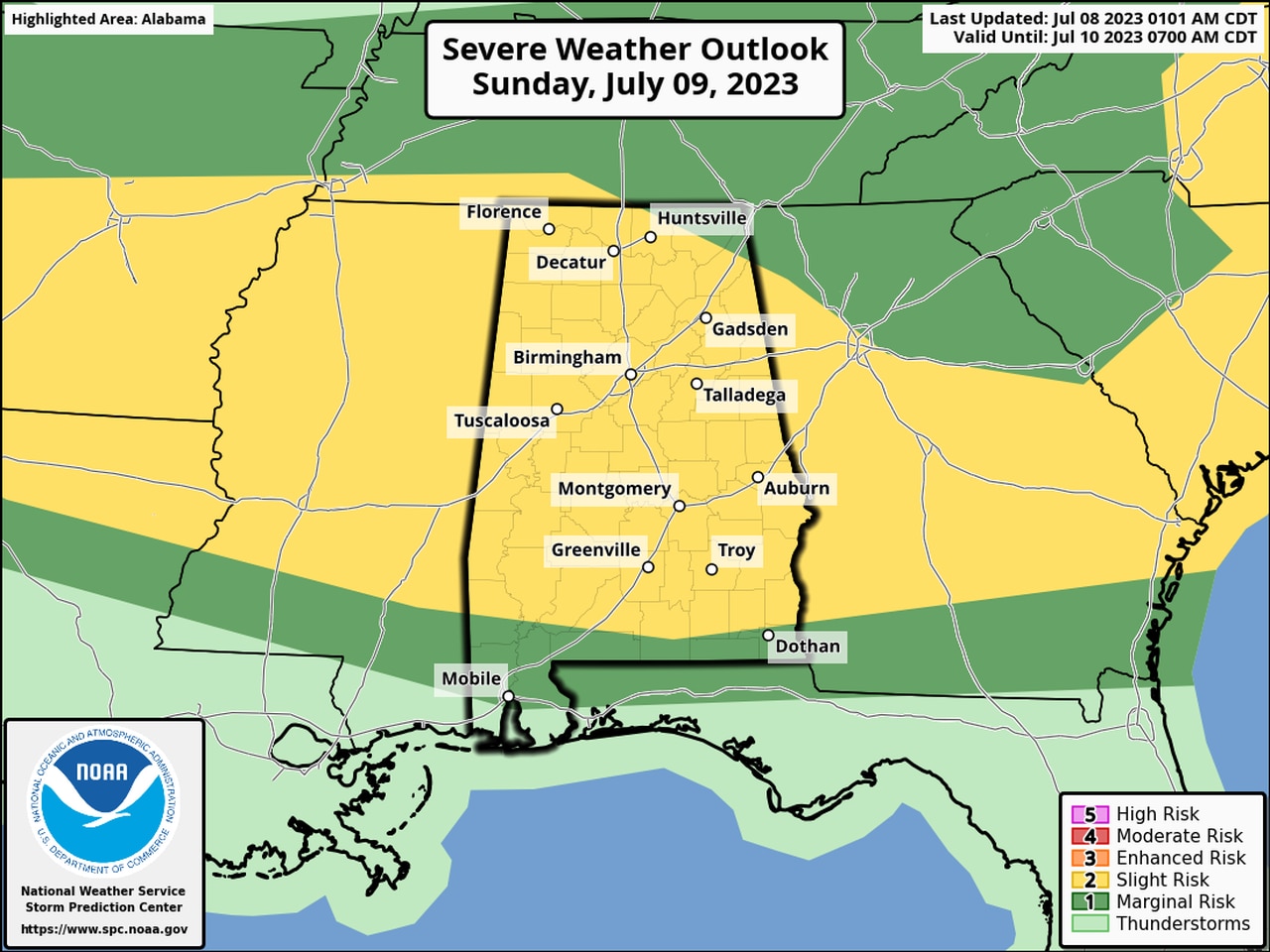
Sunday could be the most active day. The SPC has most of the state in a Level 2 risk for severe weather on Sunday. Only coastal Alabama has no severe weather risk — but it won’t be immune from seeing rain or storms, either.
Here is the severe weather outlook for Sunday:
Scattered severe storms will be possible in most of Alabama on Sunday.
On Monday the threat for stronger storms will be confined to south Alabama. The Storm Prediction Center has a Level 1 risk on Monday for that area. No severe weather or storms are expected in north Alabama or north-central Alabama.
Here is Monday’s outlook:
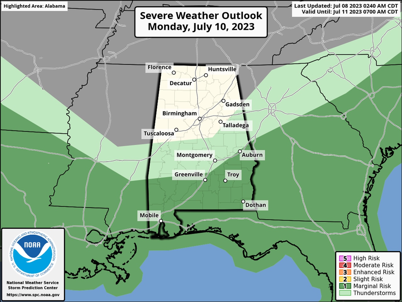
There will be a Level 1 severe weather risk on Monday for the areas in dark green.
The National Weather Service thinks there will be daily chances for rain and storms through next week, the typical summertime pattern in Alabama.
However, the Storm Prediction Center does not have Alabama included in any severe weather risks past Monday.