Strong storms possible in Alabama Friday and Saturday
More strong to severe storms could affect parts of north and central Alabama both Friday and Saturday.
Not everyone will see rain or storms, and the National Weather Service cautioned that the timing was uncertain. However, storms will be the most likely during the afternoon and evening hours both today and Friday.
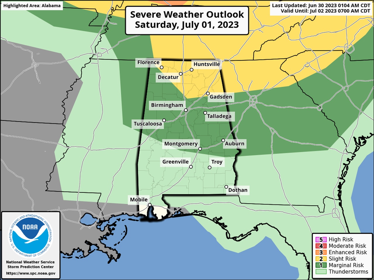
NOAA’s Storm Prediction Center has added in Level 2 and 1 risks for storms for both days. A Level 2 risk means scattered severe storms will be possible. A Level 1 risk means isolated severe storms will be possible.
Northeast Alabama has the best chance of seeing stronger storms.
The strongest storms could have wind gusts up to 60 mph, hail and heavy rain. The tornado risk is low.
It could be a similar setup to Thursday, with forecasters on the lookout for storms approaching Alabama from the north.
Storms could develop on the outer edges of a big dome (the “heat dome”) of high pressure situated to the west of Alabama. Air rotates clockwise around areas of high pressure — and the storms will too.
Meteorologists sometimes refer to that kind of stormy setup as the “ring of fire.”
More storms are in the forecast, mainly for the northern half of Alabama, on Saturday:
More storms will be possible on Saturday, mainly in the northern half of Alabama.
The setup on Saturday will be similar to today’s with storms expected mainly during the afternoon and evening hours.
The strongest storms again could bring damaging winds, hail and heavy rain.
Look for rain chances to increase some early next week. However, as of Friday no severe weather was in the forecast for Alabama next week.