Waves of severe storms possible on Sunday in Alabama
Several rounds of severe weather will be possible in Alabama on Sunday, according to forecasters.
Storms will be possible as soon as late this morning but will be the most likely during the afternoon and evening hours. Storms could last into the overnight hours as well.
The strongest storms could have wind gusts near hurricane force as well as large hail and heavy rain, according to the National Weather Service. The tornado risk is on the low side.
Storms could arrive in the form of several mesoscale convective systems, or MCSs. Those are clusters of storms that can hold together over long distances. Today’s MCSs are expected to approach Alabama from the north or northwest.
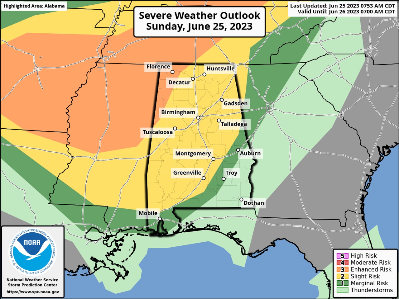
NOAA’s Storm Prediction Center has added a Level 3 out of 5 risk for severe weather for parts of west and north Alabama for today.
A Level 3 risk, or enhanced risk, means that “numerous” severe storms will be possible.
A large part of the rest of the state has a Level 2 risk for severe weather, which means that scattered severe storms will be possible.
A smaller area in southwest and southeastern Alabama has a Level 1 or marginal risk.
No severe weather is anticipated in the southeasternmost corner of the state, but rain and storms will be possible in that area as well today and tonight.
However, a Level 1 risk has been added for the southeast for Monday, which means that isolated severe storms will be possible.
In addition to storms, it could be very hot across parts of the state today, and a heat advisory will be in effect for Mobile and Washington counties.
In addition, areas that don’t see rain could see highs into the 90s today, according to forecasters.
Here’s what the National Weather Service offices across the state were thinking on Sunday:
