Severe weather expected Thursday; will it affect you?
Here we go again: More severe weather is in the forecast for Thursday for parts of Alabama.
And Friday.
And Saturday.
And Sunday.
Severe storms over the next few days will be capable of producing tornadoes, winds strong enough to take down trees and power lines, hail and flash flooding.
The storms were already rolling Thursday morning, and a tornado watch continues until 3 p.m. for part of south Alabama.
The Alabama counties in the tornado watch are Baldwin, Butler, Choctaw, Clarke, Coffee, Conecuh, Covington, Crenshaw, Escambia, Geneva, Mobile, Monroe, Washington and Wilcox.
The Storm Prediction Center said a few tornadoes will be possible in the watch area, which also includes part of the Florida Panhandle. There could also be wind gusts up to 65 mph and hail up to 2 inches (lime size).
Forecasters said the potential for supercell storms near the coast is expected to increase through the morning while other storms move southeastward into the watch area.
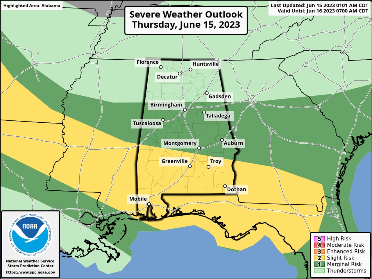
The Storm Prediction Center’s outlook for Thursday has a Level 2 out of 5 risk for severe weather for most of south Alabama, with a Level 1 risk as far north as Birmingham and Tuscaloosa.
A Level 2 risk means scattered severe storms will be possible. A Level 1 risk means isolated severe storms are possible.
North Alabama could face rain and storms today, but widespread severe weather isn’t expected.
Storms will be possible through the day and into the evening hours, according to the National Weather Service. Forecasters said they were expecting the severe threat to ramp up through mid-morning across south Alabama.
The atmosphere will be very soupy over Alabama today, so storms could drop a lot of rain in a short amount of time, and a flood watch continues for the southern part of the state through Thursday evening.
The atmosphere will remain primed for storms on Friday through the weekend, according to forecasters, and there will be risks for at least isolated severe storms each day.
The weather service said several shortwave disturbances will move through the region and could set off storms along a boundary draped across the state.
Forecasters said clusters of storms could develop along that boundary and track to the southeast toward Alabama through the weekend.
The weather service said it will be particularly watching Sunday, when a slightly stronger impulse could affect the state.
Additional rounds of rain and storms are in the forecast for next week, but so far the Storm Prediction Center doesn’t have Alabama in a severe weather risk after Sunday.