Severe weather threat in Alabama for Wednesday, Thursday: When will storms arrive?
Waves of storms are expected in Alabama Wednesday and Thursday, bringing the possibility for straight-line winds and supercell thunderstorms.
Jim Stefkovich, Meteorologist, Alabama Emergency Management Agency, said the first area of rain and thunderstorms will move across Alabama mainly north of I-20 through the Wednesday morning. For this afternoon into early evening, isolated scattered showers and thunderstorms could develop south of I-20, with the possibility of straight-line wind gusts and hail.
The overall severe threat is low with no tornado development expected, Stefkovich said.
Thursday’s storms could be more severe.
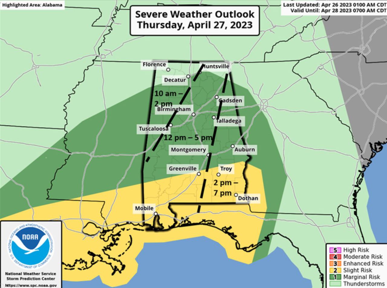
A “potent” storm system will produce clusters of thunderstorms that will move into northwest Alabama during the late morning and move west to east across the state, exiting the eastern portions of the state between 10 p.m. Thursday and midnight Friday, EMA said.
The storm could bring straight-line wind gusts and hail as the main threats, especially north of Highway 80/I-85. The area south of Highway 80/I-85, a portion of the state in the “slight risk” area could see a few supercell thunderstorms with the risk for a couple of tornadoes.
Thursday’s storms will enter the northwestern part of the state around 10 a.m. to 2 p.m. The storms will move across the central and southern part of the state from noon until 5 p.m. before exiting through the east around 7 p.m.