A few strong storms possible in parts of Alabama Thursday
Strong storms will be possible today across a large part of Alabama, and a tornado watch has been issued for a few counties in the southeast.
The tornado watch will be in effect until 1 p.m. CDT for the Alabama counties of Coffee, Covington, Dale, Geneva, Henry and Houston, according to the National Weather Service.
Forecasters were watching a band of rain and strong to severe storms — not unlike a rain band from a tropical system — pushing northward over that area from the Gulf of Mexico.
The Storm Prediction Center said a couple of tornadoes will be possible in the watch area, which also includes parts of the Florida Panhandle and south Georgia, as well as damaging wind gusts up to 70 mph.
Rain and storms were affecting other parts of Alabama on Thursday morning, and strong storms will be possible there today as well as that rain band in south Alabama moves northward.
All the activity was rotating counterclockwise around an area of low pressure located to the west of Alabama.
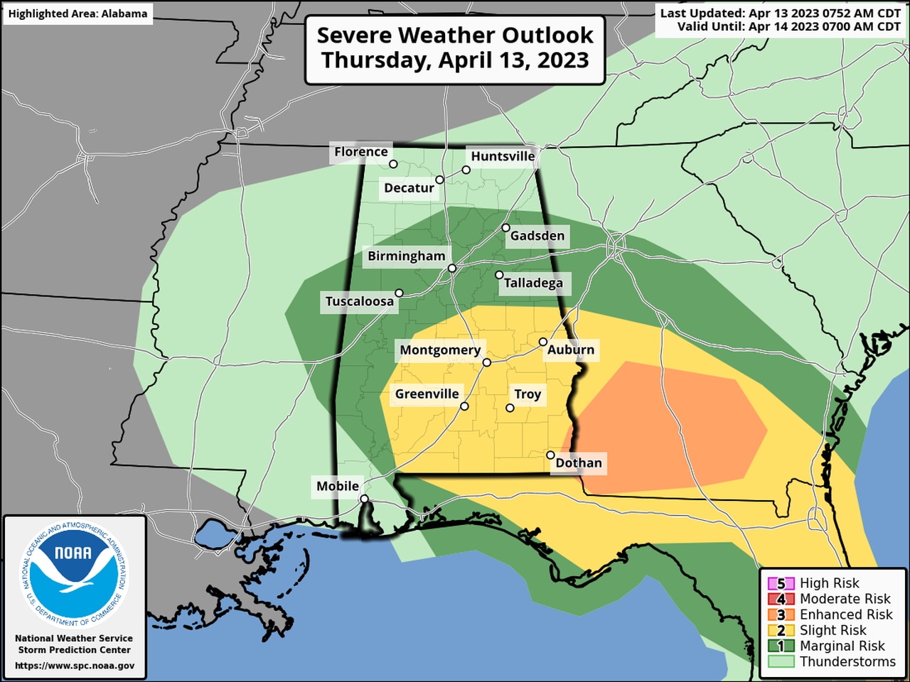
The Storm Prediction Center has added a Level 3 out of 5 risk for severe weather for a small part of southeast Alabama in its latest update on Thursday morning.
A larger area that includes more of southeast and south Alabama and part of central Alabama has a Level 2 risk, which means that scattered severe storms will be possible.
More of central and west Alabama has a Level 1 risk and could see isolated severe storms.
Southwest Alabama and north Alabama aren’t expected to have severe weather concerns today, according to forecasters.
The strongest storms could have damaging winds and heavy rain, and a tornado or two will also be possible, the weather service said.
Rain could linger into Friday as the system pushes off to the northeast.
Rain could return again on Saturday and Sunday, but no severe weather is expected.