Severe weather risk increases for south Alabama today
Severe weather got started early in Alabama on Monday, and a tornado watch is in effect for the southern part of the state.
NOAA’s Storm Prediction Center said the tornado watch will be in effect until 11 a.m.:
Forecasters said a couple of tornadoes will be possible in the watch area, which also includes parts of Mississippi and the Florida Panhandle. Hail and damaging winds will also be possible.
The Alabama counties in the watch are Baldwin, Choctaw, Clarke, Conecuh, Covington, Escambia, Mobile, Monroe and Washington.
The Storm Prediction Center has a Level 2 out of 5 risk for severe weather for part of south Alabama today, which means that scattered severe storms will be possible.
Other areas in south and central Alabama have a Level 1 risk and could see isolated severe storms. No severe weather is expected across north Alabama today.
The National Weather Service was tracking storms moving across the southern part of the state and more storms back into Mississippi. Some of those have become severe. Rain was also falling across parts of central Alabama as well early Monday, but severe weather was not expected there.
More storms could be possible later this afternoon as well. They are expected to be more isolated than this morning’s action, but if storms do form they could become intense, according to the weather service.
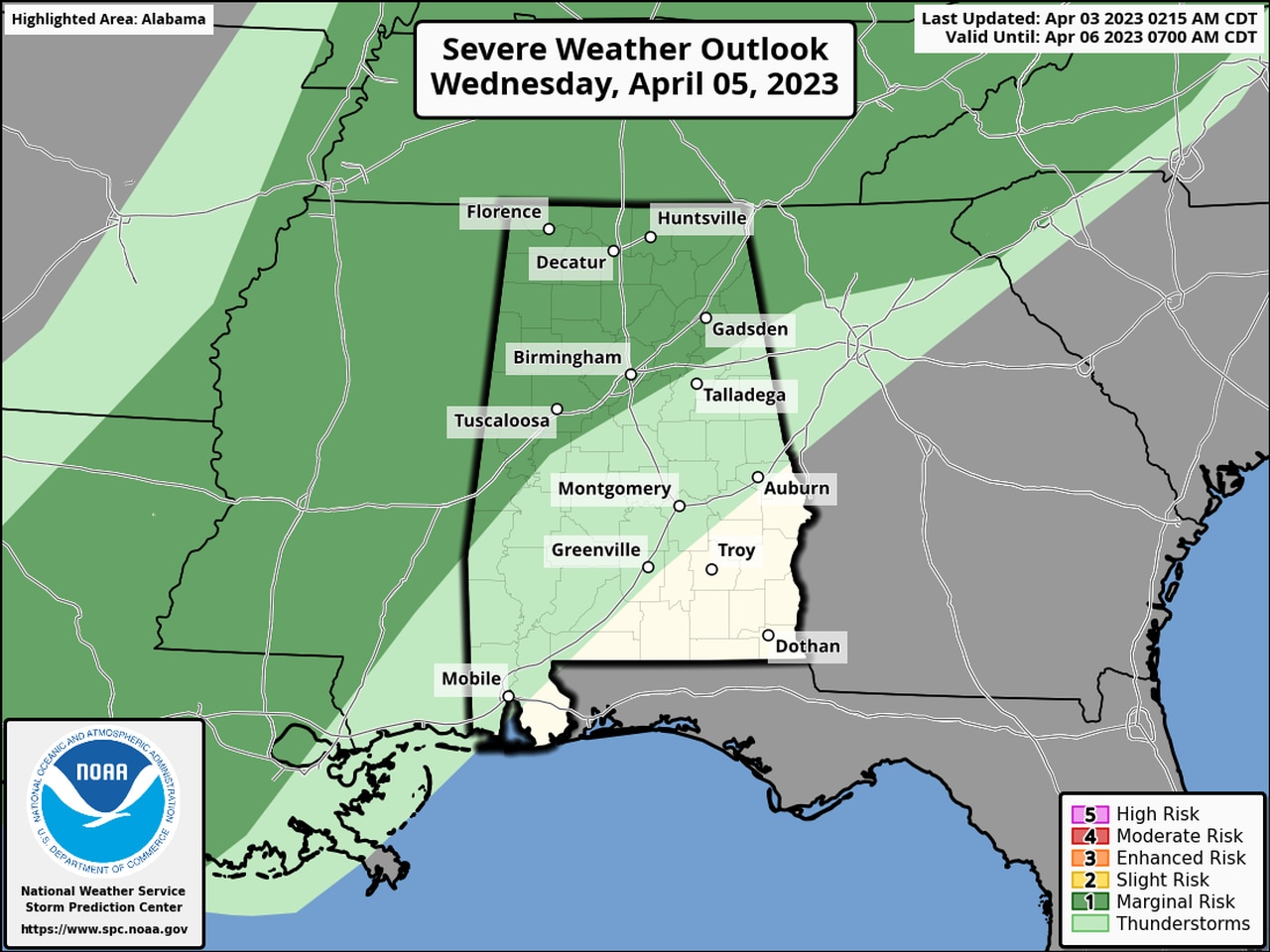
This may not be the only round of severe storms this week for Alabama. The Storm Prediction Center has added a Level 1 risk for severe weather for part of Alabama for Wednesday:
The areas in dark green could see isolated severe storms on Wednesday.
