A few severe storms possible in south Alabama today
Rain and storms continued to move across parts of Alabama on Saturday morning, and a few severe storms will be possible in the southeastern part of the state today ahead of a cold front.
It was a busy night for the National Weather Service offices in Huntsville and Birmingham, both of which had to issue multiple tornado and severe thunderstorm warnings overnight.
So far storm damage reports posted to the weather service were sporadic, but several areas have reported trees down and some power outages, including the Bear Creek area of Marion County and the Haleyville area in Winston County.
The front continued to push through the state on Saturday morning along with rain and storms.
The National Weather Service said those storms could intensify again later today as temperatures rise, and a few severe storms could be possible.
Forecasters said damaging winds are the main concern, but tornadoes can’t be ruled out, either.
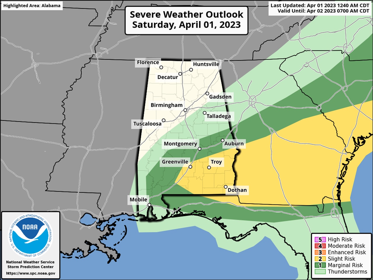
NOAA’s Storm Prediction Center has a Level 2 risk for severe weather across the southeast part of Alabama today, including areas such as Troy, Dothan and Greenville.
A Level 2 risk means scattered severe storms will be possible.
Other areas in southeast and south Alabama have a Level 1 risk for severe weather, which means that isolated severe storms will be possible.
The severe weather threat was over for north and most of central Alabama.