A few storms possible Saturday; more on Sunday
A few strong storms will be possible for parts of Alabama today (Saturday), but the worst of the weather is over — until Sunday, according to the National Weather Service.
Storms were affecting south Alabama on Saturday morning. A tornado warning has been issued for Geneva County in south Alabama. It will be in effect until 8 a.m.
The National Weather Service said that as of 7:30 a.m. the storm was located near Samson, or 7 miles west of Geneva, and was moving northeast at 35 mph. This was a radar-indicated tornado.
NOAA’s Storm Prediction Center is maintaining a Level 1 risk for severe weather for parts of south and east Alabama today, which means that isolated severe storms will be possible.
It was a busy night for the weather service. Forecasters on Friday and early Saturday issued multiple tornado and severe thunderstorm warnings, and damage has been reported in several areas in north and north-central Alabama.
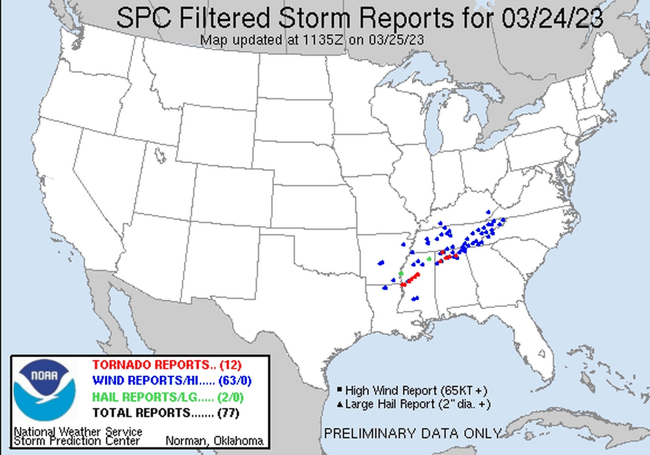
Here’s a look at preliminary storm reports from the SPC:
One supercell storm may be responsible for a string of tornado reports across both Mississippi and Alabama. The red icons indicate tornado reports, not necessarily separate tornadoes.
However, it appears Alabama was spared the worst of Friday’s weather after what appeared to be strong tornadoes tore through several areas in Mississippi on Friday. At least 23 people died on Friday in that state, with some still missing, according to state officials.
Alabama could end up with its share of tornadoes, too. The weather service in Huntsville has not announced any plans just yet to look at storm damage in north Alabama, and the weather service in Birmingham said a storm survey in Marion County will likely be scheduled for Monday.
Meteorologists will take a look at storm damage and determine if it was caused by tornadoes or straight-line winds. If a tornado is confirmed then it will be given a rating using the Enhanced Fujita Scale.
Unfortunately, another round of severe weather looks to be possible on Sunday, this time for southern Alabama.
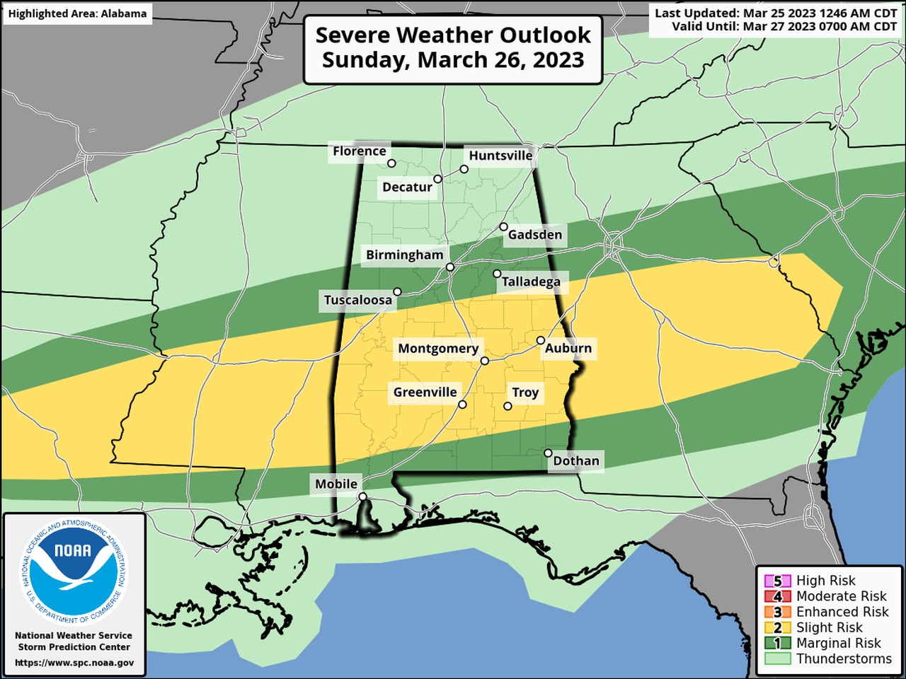
The areas in yellow will have a Level 2 risk for severe weather on Sunday. Areas in dark green will have a Level 1 risk.
The Storm Prediction Center has a Level 2 out of 5 risk in place for parts of south and south-central Alabama on Sunday. A Level 2 risk means isolated severe storms will be possible.
Areas to the north, into central Alabama, and also to the south will also have a Level 1 risk on Sunday, which means isolated severe storms will be possible.
Sunday’s storms could bring damaging wind gusts, hail, heavy rain and also the threat for a tornado or two.
Storms will be possible from the late morning hours into the evening on Sunday as a warm front lifts northward over the state.
Areas along and south of the warm front have a better chance of seeing storms, according to the weather service.