Tropical depression possible in Caribbean this week
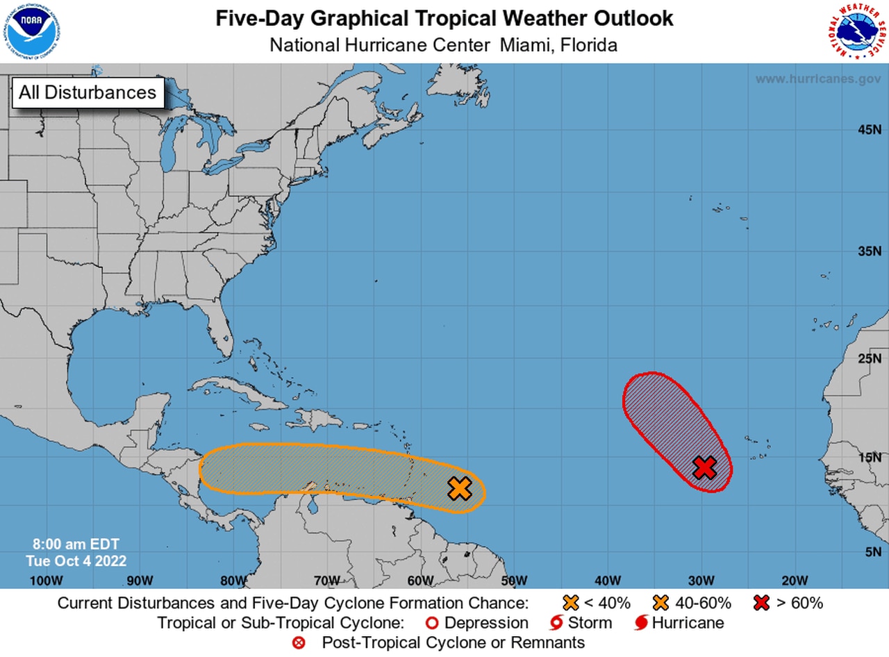
The National Hurricane Center continued to track two tropical disturbances on Tuesday, and both of them could become tropical depressions this week.
The one most likely to reach that threshhold first was in the eastern Atlantic and not expected to be a concern for the U.S.
The second wave, however, will track into the Caribbean. And anything that gets into the Caribbean this time of year will be watched closely. A reconnaissance aircraft is scheduled to take a closer look at that wave this afternoon.
The eastern wave was located a few hundred miles southwest of the Cabo Verde Islands on Tuesday.
It’s in a good area for development, and the hurricane center said a tropical depression could form in the next day or two as the disturbance tracks to the northwest at about 10 mph.
Conditions are expected to become less favorable by Wednesday or Thursday, forecasters said.
The other system, the one that will be watched by those in the U.S., was located a few hundred miles east of the southern Windward Islands on Tuesday.
The hurricane center said there’s no sign of organization yet, but rain and storms were increasing in its vicinity.
It is expected to move through the Windward Islands tonight and into Wednesday.
The hurricane center said some slow development will be possible as it moves into the Caribbean. Forecasters added that a tropical depression could form by late in the week. The disturbance is expected to be in the central or western Caribbean by that point.
The hurricane center said that an Air Force Reserve Hurricane Hunter aircraft is scheduled to investigate this system this afternoon, if necessary.
The disturbance has a 40 percent chance of becoming a depression in the next five days.
The next two names on the Atlantic list are Julia and Karl.
There were no other systems being monitored for development in the Atlantic as of Tuesday morning.
