Alabama severe weather: When to expect more storms
Alabama is facing yet another round of severe weather. This one is set to begin early Friday morning.
The key points:
* Strong to severe storms are expected to approach Alabama from the west early Friday morning — as early as 4 a.m. — and track eastward through the day.
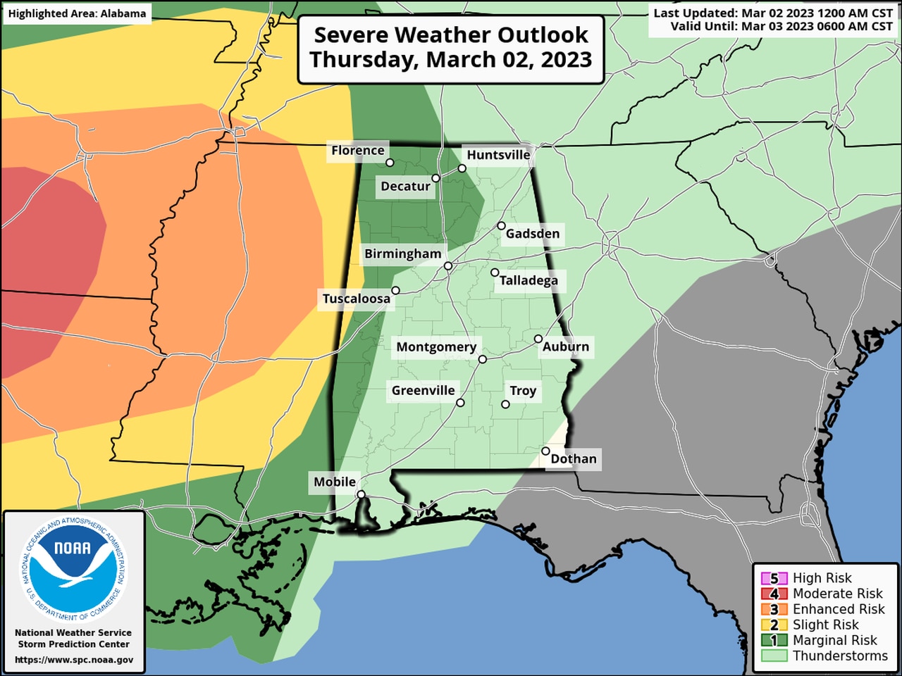
* All of the state is at risk of seeing strong storms, with the northern two-thirds of Alabama again having the better probability of severe weather. NOAA’s Storm Prediction Center has all of north Alabama and most of central Alabama in a Level 2 risk for severe weather on Friday. A Level 2 risk means that scattered severe storms will be possible. The southern part of Alabama has a Level 1 risk for severe weather, which means that isolated severe storms will be possible.
* Storms could reach Huntsville on Friday between 7 a.m. and 10 a.m., Birmingham between 6 a.m. and 10 a.m., Montgomery between 8 a.m. and noon and Mobile between 7 a.m. and 11 a.m., according to National Weather Service forecasts. Keep up with the forecast because these times could be adjusted before storms arrive.
* Tornadoes, damaging winds, hail and flooding rain will all be possible.
* It will also be very windy, even without storms around, and power outages will be possible starting late tonight. A wind advisory will be in effect for the entire state on Friday.
* A flood watch remains in effect for all of north Alabama through Friday.
* Isolated strong to severe storms will be possible starting this afternoon in western and part of north Alabama, but no widespread severe weather is expected during the day today for the rest of the state.
Friday’s expected round of storms will follow an active Thursday night for those in north and north-central Alabama.
The National Weather Service offices in both Huntsville and Birmingham had to issue multiple tornado and severe thunderstorm warnings from Thursday evening late into the night. Some damage has been reported following the storms, and storm survey teams may take a look at a few areas later today to determine if tornadoes touched down.
In addition many areas in north Alabama experienced flash flooding due to multiple rounds of heavy rain. A flood watch remains in effect for all of north Alabama until 6 p.m. Friday.
Tornadoes, damaging winds, hail and heavy rain will again be possible overnight ahead of a cold front expected to approach the state early Friday morning.
It will also be another windy day — both near and away from storms — and the entire state will be under wind advisories later today. The National Weather Service cautioned that it could be windy enough to bring down tree limbs and knock out power.
With storms expected overnight that makes it extremely important for Alabamians to make sure their devices are charged tonight and that they have more than one way to get severe weather warnings if needed when they are asleep.
Widespread severe weather isn’t expected in Alabama during the day today, but a few strong to severe storms could be possible in the western and northern part of the state.
NOAA’s Storm Prediction Center has a Level 1 risk for severe weather in those regions. A Level 1 risk means isolated severe storms will be possible. The rest of the state is not expected to see severe weather today.
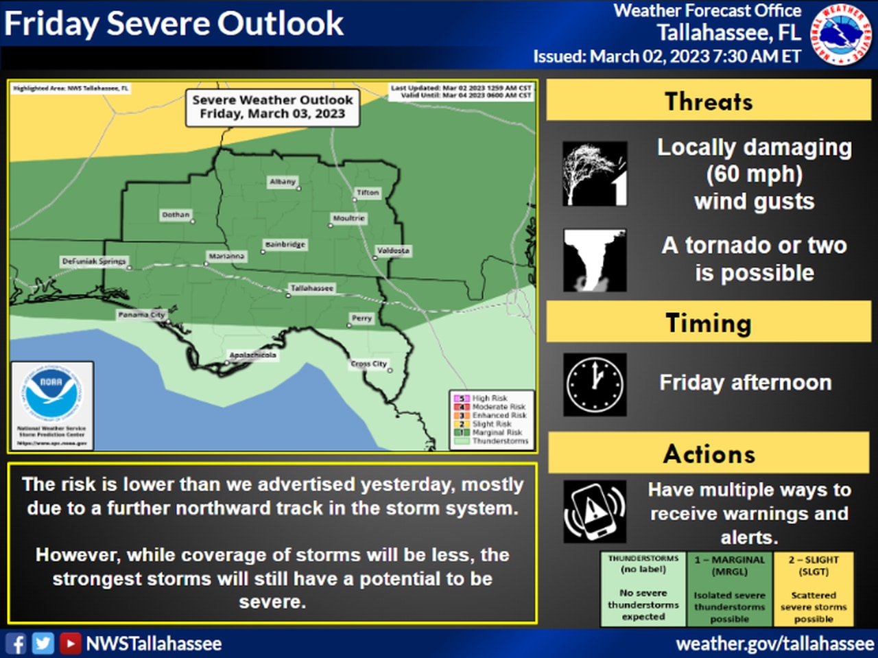
Here is Thursday’s severe weather outlook:
Isolated severe storms could be possible in the areas in dark green this afternoon.
That will change by Friday morning, however.
A line of severe storms could approach Alabama’s western border by 4 or 5 a.m. Friday and track quickly eastward through the morning hours, according to the National Weather Service. (Friday’s severe weather outlook is at the top of this post.)
Cities such as Huntsville, Birmingham and Montgomery could see the brunt of the bad weather roughly between 6 and 10 a.m. Friday. Areas in eastern Alabama could see storms from 8 a.m. until noon.
Here is a look at the timing for Alabama from the National Weather Service:
NORTH ALABAMA
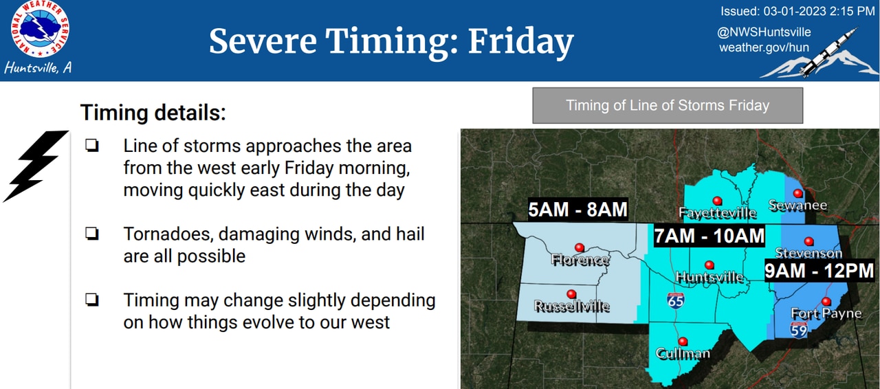
Storms could reach northwest Alabama by 5 a.m. Friday and head eastward through the morning.
CENTRAL ALABAMA
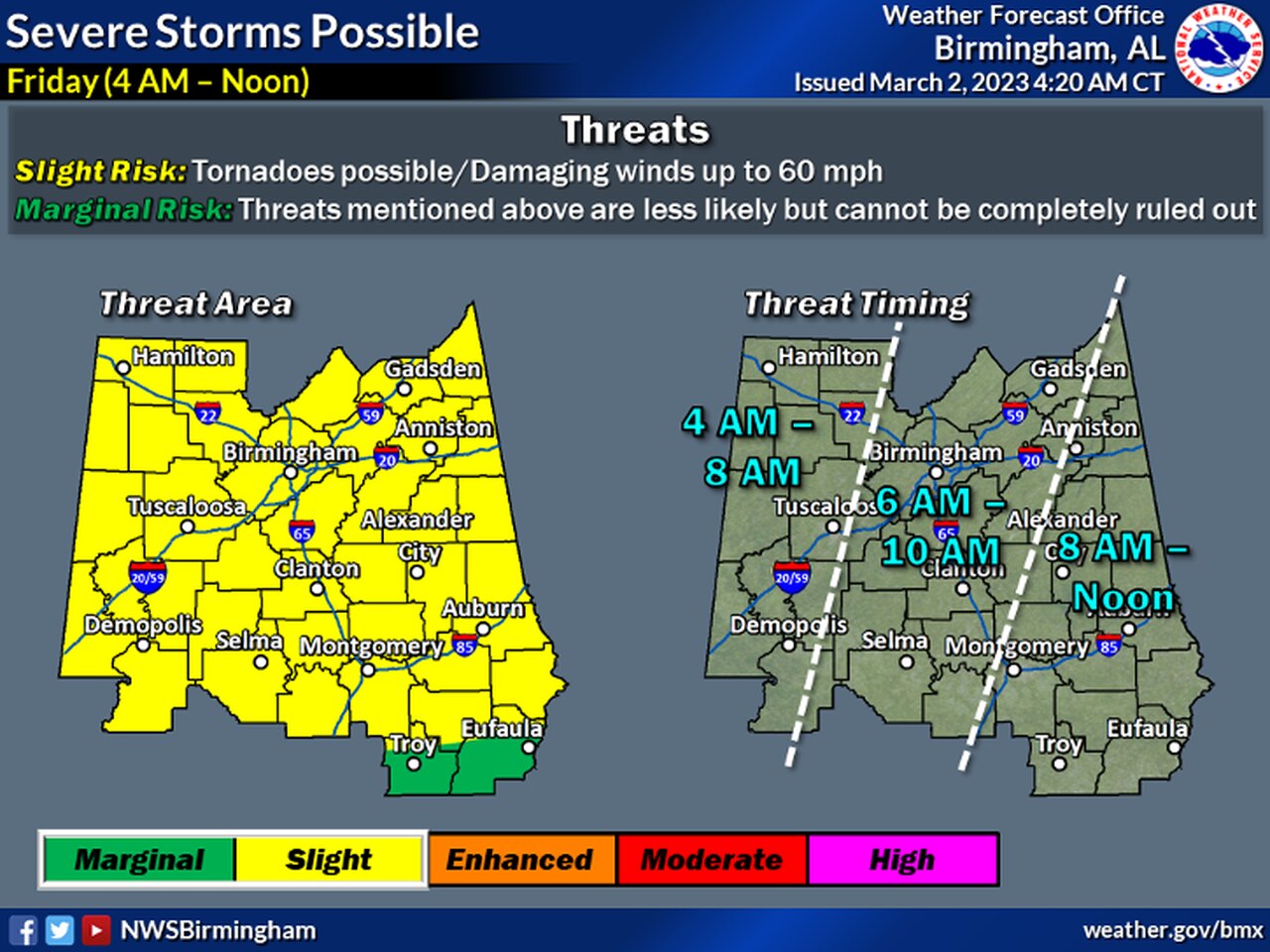
Storms could reach west-central Alabama by 4 a.m. Friday and affect the Birmingham metro area between 6 and 10 a.m.
SOUTHWEST ALABAMA
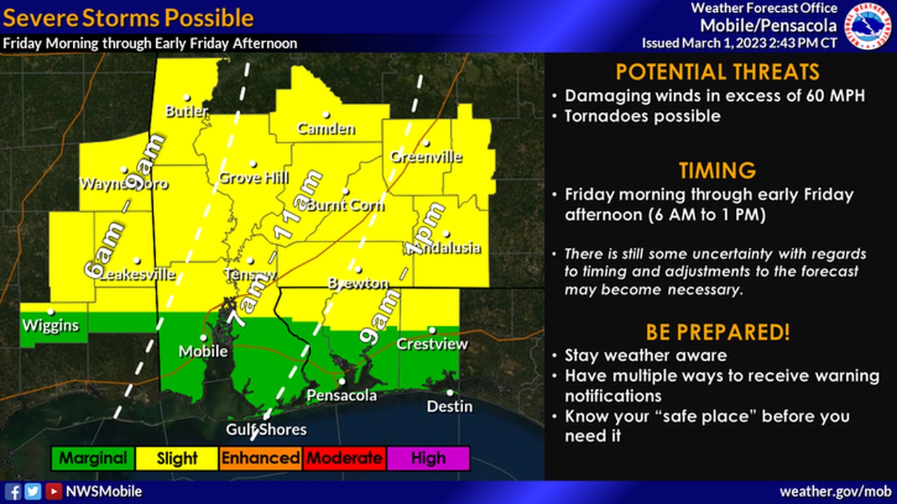
Forecasters think storms could reach southwest Alabama by 4 a.m. Friday and track eastward, reaching Mobile between 7 and 11 a.m.
SOUTHEAST ALABAMA
Southeast Alabama will be the last to see storms, which could reach that corner of the state by Friday afternoon.
The storms are expected to move out of Alabama on Friday afternoon, and cooler and drier weather is expected over the weekend.
Temperatures will be closer to average for early March on Saturday and Sunday but should begin to warm up again next week, forecasters said.