Severe storms possible across Alabama today and tonight
A rainy day was in store for Alabama, and there will be the possibility of a few strong storms in the mix.
Rain and storms were already moving over parts of Alabama as of Wednesday morning, and some have prompted severe thunderstorm warnings. There could also be a better chance for strong storms later this afternoon and tonight as a cold front approaches Alabama.
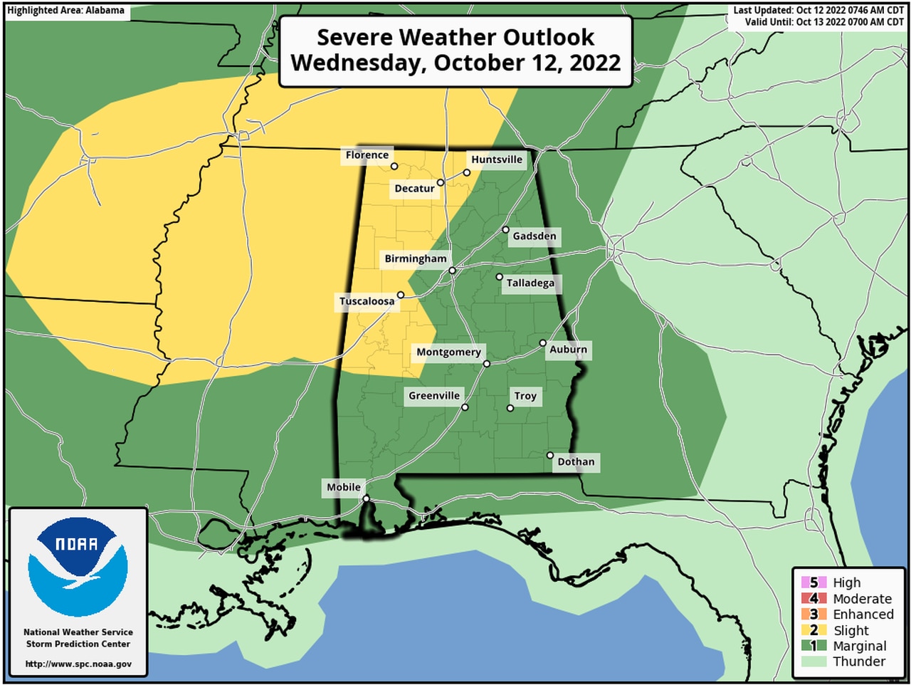
NOAA’s Storm Prediction Center has added — and now expanded — a Level 2 out of 5 severe weather risk that now includes parts of north and west Alabama for Wednesday. A Level 2 risk means that scattered severe storms will be possible.
The rest of Alabama has now been added to a Level 1 risk for severe weather, which means that isolated severe storms will be possible.
The strongest storms could bring damaging wind gusts up to 60 mph. The National Weather Service said the tornado threat is very low, but it is not zero. And heavy rain will be possible with the strongest storms.
The Storm Prediction Center was watching south and central parts of Alabama on Wednesday morning for the possibility of early storms with large hail.
Egg-size hail has been reported near Gallion in Hale County this morning from a severe storm that moved through.
More storms will be possible through the day today, and a final round could arrive later tonight ahead of a cold front, although it’s unclear how robust that line of storms will be.
South Alabama has now been included the the Level 1 severe weather risk area as of the latest update.
There could be multiple rounds of rain and storms, the weather service said, so there could be a limited risk for flash flooding:
Drier weather is expected to return during the day on Thursday, but the next weather system will bring rain chances back to the state by Sunday into Monday.
There could also be a shot of really cool air behind that front with the potential for frost for some parts of the state early next week.