Isolated severe storms possible Wednesday in Alabama
Remember thunderstorms? And rain? Both are part of the weather forecast for Wednesday, according to the National Weather Service.
Forecasters said a storm system will bring the possibility of strong to severe storms to at least part of the state from Wednesday into early Thursday.
NOAA’s Storm Prediction Center thinks there will be a Level 1 out of 5 risk for severe weather in north and central Alabama on Wednesday.
A Level 1 risk means that isolated severe storms will be possible. The main concern with any severe storms that develop are damaging wind gusts up to 60 mph and possibly some hail. Forecasters said the threat of a tornado is low but it can’t be ruled out entirely.
That marginal risk area could be expanded southward at some point depending on when storms begin on Wednesday, according to the weather service.
For north Alabama, the weather service in Huntsville said the best time for storms will be Wednesday evening into Wednesday night:
For central Alabama, the window for storms on Wednesday will be from roughly 2 p.m. until midnight, according to the weather service in Birmingham:
Storms and rain could get going earlier for those in south Alabama, forecasters in Mobile said.
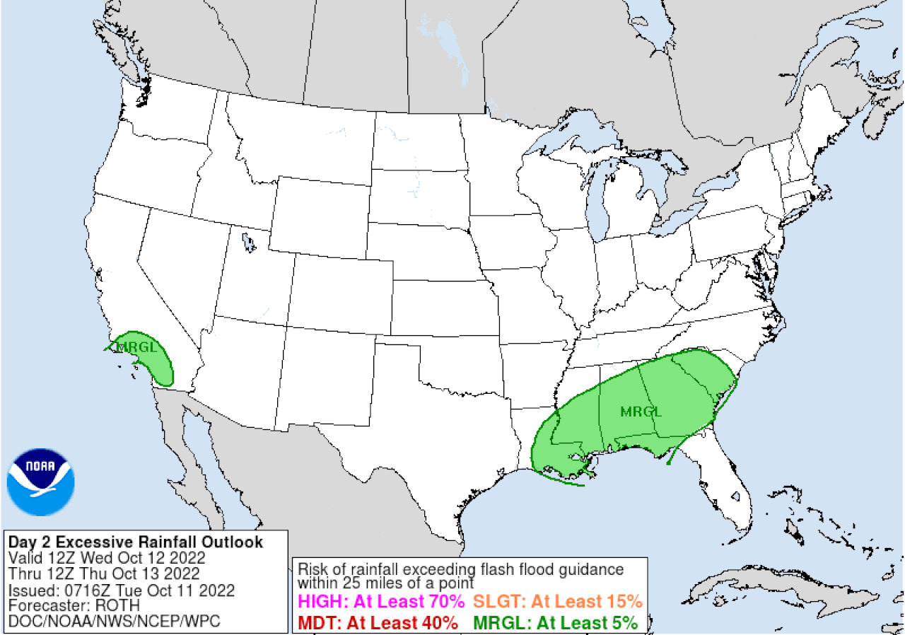
Alabama could get some much-needed rain. NOAA’s Weather Prediction Center has added a Level 1 out of 4 risk for flash flooding for a large part of the state for Wednesday. Here’s the excessive rainfall outlook:
There could be a marginal risk for flash flooding for much of Alabama on Wednesday.
However, the weather service thinks that the potential for flooding is on the low side because it has been so dry lately across the state.
Drier weather is expected to return on Thursday, and the next system is expected to affect the state over the weekend.