Alabama severe weather updates: New watch for Alabama
Severe weather will be possible across all of Alabama on Thursday.
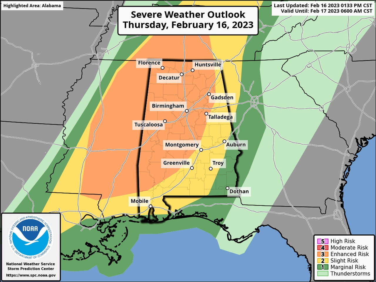
There is a Level 3 out of 5 risk for severe weather for a large part of west and north Alabama for the rest of the afternoon into tonight. A Level 3 (enhanced) risk means numerous severe storms will be possible.
There are now two tornado watches in effect for Alabama.
The first watch will be in effect for several north Alabama counties until 7p.m.:
The Storm Prediction Center said tornadoes — including a few strong ones — will be possible in the watch area, as well as wind gusts up to 70 mph (that’s almost hurricane force) and hail.
The Alabama counties in that watch are Colbert, Franklin, Lauderdale, Lawrence, Limestone, Madison and Morgan. Cullman County has also been added to the watch as of 1:53 p.m.
The second tornado watch affects central and south Alabama and will be in effect until 8 p.m.:
The counties in the second watch are Autauga, Bibb, Blount, Chilton, Choctaw, Clarke, Dallas, Fayette, Greene, Hale, Jefferson, Lamar, Marengo, Marion, Monroe, Perry, Pickens, Shelby, St. Clair, Sumter, Tuscaloosa, Walker, Washington, Wilcox and Winston.
Storms were developing in parts of the state on Thursday afternoon, though none was severe yet in Alabama.
The National Weather Service will keep an especially close watch on western Alabama, which has the highest probability of seeing severe weather.
Storms will be possible through tonight. Much colder air is expected to move into Alabama on Friday.
Live updates:
1:53 p.m.: The National Weather Service in Huntsville has expanded an ongoing tornado watch for north Alabama to include Cullman County. The watch will be in effect until 7 p.m.