Severe weather risk increases for Alabama on Thursday
Confidence has increased about the threat for severe weather in Alabama on Thursday.
Tornadoes, wind gusts up to 70 mph, hail and heavy rain will all be possible on Thursday, starting as soon as late morning in west Alabama and pushing eastward through the nighttime hours.
There will also be a risk of a few strong storms late tonight for the northwest corner of the state.
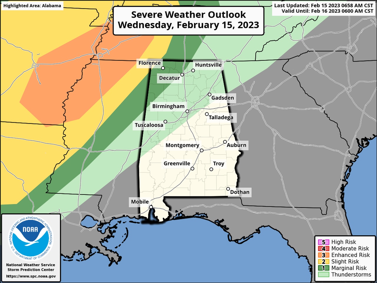
NOAA’s Storm Prediction Center has raised Thursday’s severe weather risk to Level 3 (out of 5) for parts of west and central Alabama. (Thursday’s risk areas are in the map at the top of this post.)
A Level 3 risk, or enhanced risk, means that “numerous” severe storms will be possible.
The rest of the state is not out of the woods, either, and has a Level 2, or slight risk, for severe weather. A Level 2 risk means that scattered severe storms will be possible.
A few strong to severe storms will also be possible late tonight, according to the National Weather Service.
A Level 1 risk for severe weather is in place for later tonight for northwest Alabama. Storms could be possible there from after midnight through early Thursday morning.
Here is the severe weather risk map for late tonight into early Thursday morning:
There could be an isolated severe storm late tonight in northwest Alabama.
Then forecasters are thinking there will be a break before another round of storms moves in starting late Thursday morning or Thursday afternoon.
Storms will develop ahead of a cold front approaching from the west.
The weather service will be on the lookout for supercell storms that could develop ahead of the main line of storms.
Tornadoes, damaging winds and hail will all be possible on Thursday afternoon though the nighttime hours.
The Storm Prediction Center has an increased tornado risk for parts of western Alabama for the Thursday afternoon activity:
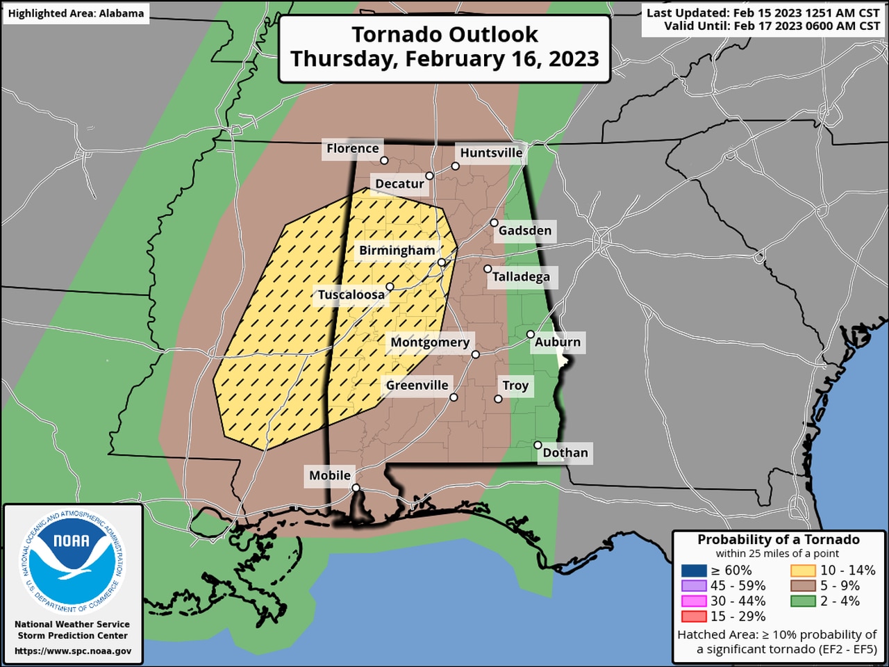
The areas in yellow will have an increased risk for tornadoes on Thursday.
The storms are expected to move out overnight on Thursday, and much cooler weather is expected on Friday.
Temperatures are expected to warm back up by Sunday and Monday, but no severe weather is currently expected next week.
Here is a look at what the National Weather Service offices across the state are expecting on Thursday:
North Alabama:
Central Alabama:
Southwest Alabama:
Southeast Alabama: