Alabama weather: 3 things to watch over the next week
Alabama’s weather will veer from winter to spring over the next few days, and there are several systems that the National Weather Service will be monitoring.
The first comes on Saturday. An area of low pressure is expected to develop along the Gulf Coast and spread rain over Alabama on Saturday.
No severe weather is expected, but there’s a chance there could be a few snowflakes on the backside of the system as it moves east of Alabama late Saturday into Sunday, according to the weather service.
No major impacts are expected at this point, and those in the higher elevations of east and northeast Alabama may be the only ones that see snowflakes — and even they may not see any at all. It will all depend on how low temperatures can get Saturday night into Sunday morning.
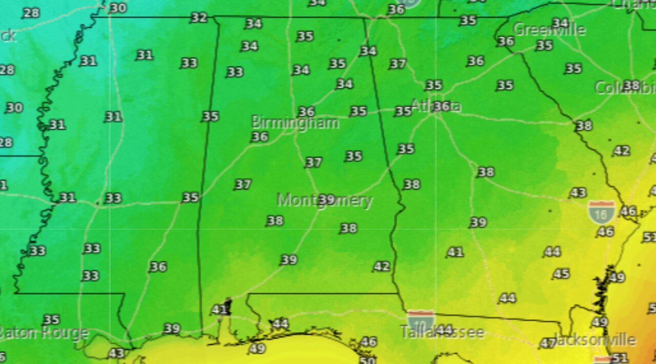
Here are the low temperatures expected Saturday night into Sunday morning:
Here are the low temperatures expected Saturday night into Sunday morning. Most of Alabama will stay above freezing.
Here’s the forecast for 6 a.m. Sunday. It shows the possibility of a rain-snow mix over east and north Alabama:
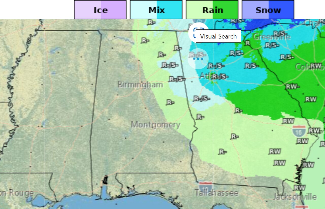
A few snowflakes or a rain-snow mix may be possible in eastern and northern Alabama late Saturday into early Sunday morning. The forecast above is for 6 a.m. Sunday.
Forecasters noted that models are offering up varying scenarios of how it may play out, so forecast confidence is low as of Friday morning.
As of this point no major accumulations or travel issues are expected, according to the weather service.
LOOKING STORMY NEXT WEEK
The next two weather events to watch will come next week — one on Tuesday and a bigger one on Thursday.
The weather service said two different weather systems will bring the potential for rain and storms back to Alabama.
The Tuesday system could spawn some storms — and some strong ones — but so far no widespread severe weather is expected in Alabama. Rain could also last into Wednesday.
Thursday’s system could be stronger. NOAA’s Storm Prediction Center has already put the entire state into an area to watch for severe weather for next Thursday, Feb. 16 (see the map at the top of this post for Thursday’s severe weather outlook).
The National Weather Service said tornadoes and damaging winds look to be possible as a cold front pushes through the state.
The forecast will likely evolve over the next few days, so be sure and keep an eye on things this weekend and into next week.