5 questions about Alabama’s threat for winter weather
There’s a chance for some snow in Alabama late this weekend and into early next week as Arctic cold front and airmass makes its way into the state.
There are still more questions than answers about what could happen in regards to wintry precipitation, but here’s what the National Weather Service was thinking on Thursday:
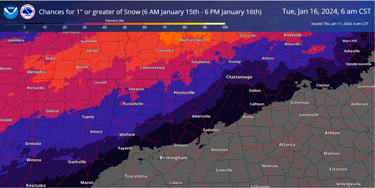
1. Will it snow? Really?
Here are the chances for 1 inch or more of snow for Alabama.NWS
The National Weather Service in Huntsville said a light wintry mix or light snow is possible late Sunday night into Monday and again Monday night into early Tuesday morning in north Alabama.
The National Weather Service in Birmingham said there will be a chance of wintry precipitation across the northern part of Central Alabama from late Sunday night into Monday night. It could come in the form of snow or sleet and freezing rain, with only rain expected in the southern part of the region.
The weather service in Mobile said as of Thursday morning forecasters were thinking that temperatures in south Alabama will stay above freezing and only a cold rain is likely. If the Arctic front moves faster than expected or moisture lingers behind it, then the parts of the region could see a light wintry mix in areas far from the coast.
2. How much?
It’s too soon to say. As of Thursday morning forecasters weren’t really speculating on accumulations. The weather service in Huntsville said there was low confidence in snow totals but forecasters were thinking impacts would be minor. The weather service added that the greatest potential for snow accumulations exceeding 1 inch and any minor impacts was across far northwest Alabama.
3. When will it start?
Models are still disagreeing on timing for the weekend system, but as of Thursday morning forecasters think wintry precipitation could be possible in Alabama starting Sunday night.
4. When will it end?
Again, forecast models differ, but wintry precipitation is expected to be done by Monday night/early Tuesday morning.
5. How cold will it be?
There is higher confidence about temperatures. Highs on Sunday will be in the 40s and 50s:
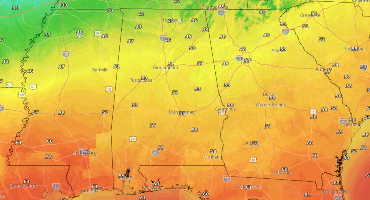
Sunday’s highsNWS
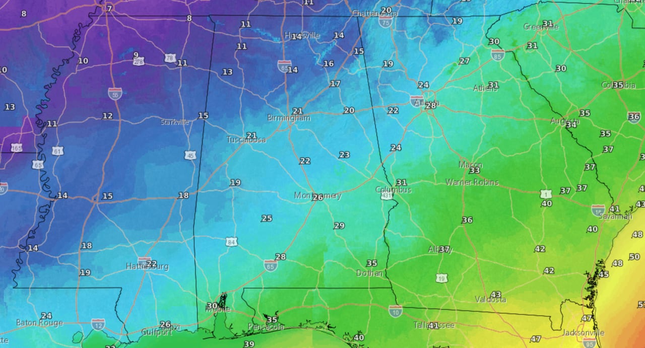
Then the cold begins to roll in. Here are the forecast lows for Sunday night into Monday morning:
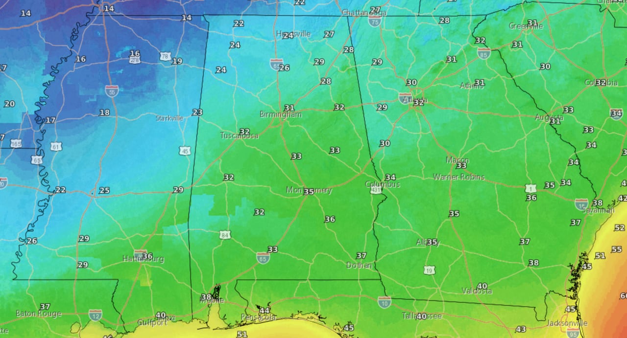
Forecast lows for Sunday night into Monday morning.NWS
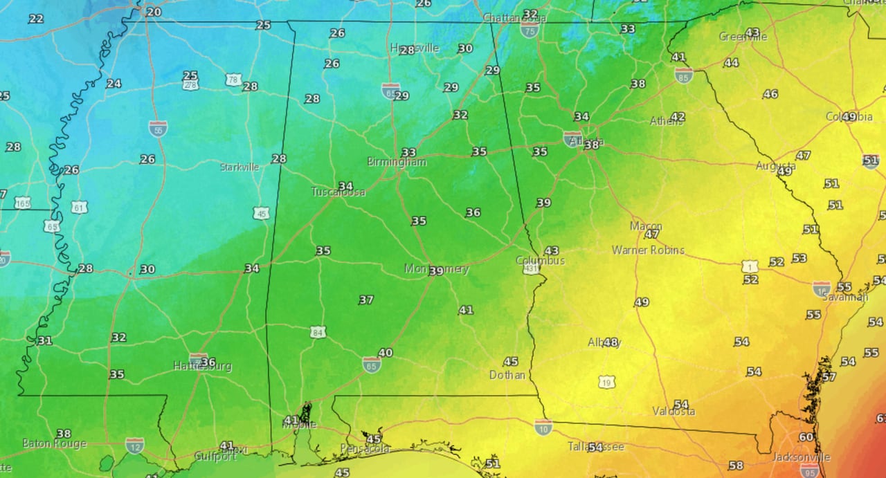
There will be a stark contrast in temperatures across Alabama on Monday. Here are Monday’s highs:
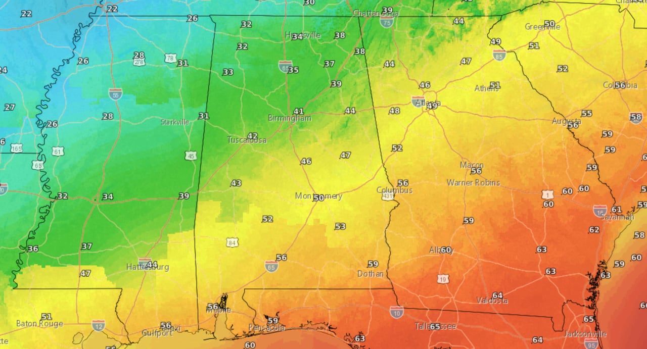
Highs expected on Monday.NWS
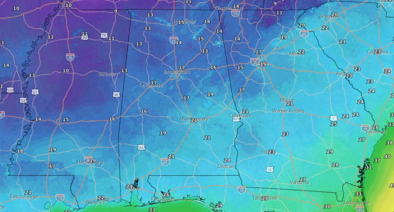
Then everyone goes into the freezer from Monday night into Tuesday morning:
Forecast lows from Monday night into Tuesday morning.NWS
High temperatures on Tuesday won’t make it out of the 20s in north Alabama and will only reach the 40s in south Alabama:
Forecast high temperatures on Tuesday.NWS
Wednesday morning will likely be the coldest, with lows in the teens expected in north and north-central Alabama and low 20s all the way down to the coast:
Here are the lows from Tuesday night into Wednesday morning.NWS
Temperatures are expected to warm up slightly at the end of the forecast period on Wednesday:
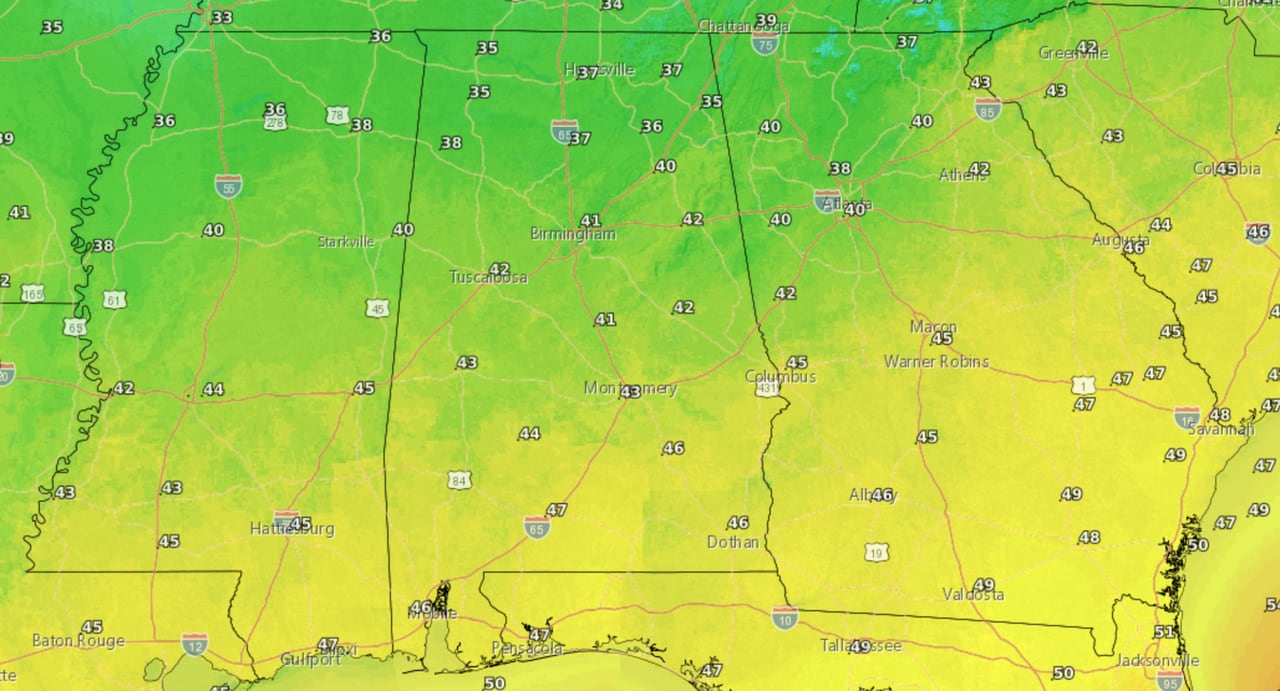
Forecast highs for Wednesday.NWS