Isolated severe storms possible Sunday in Alabama
Keep an eye out of for storms this afternoon if you are in north and east Alabama.
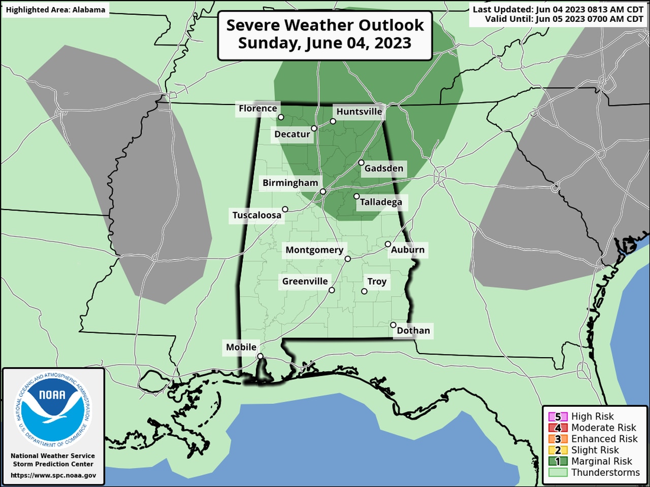
NOAA’s Storm Prediction Center has added a Level 1 out of 5 risk for severe storms this afternoon for nearly all of north Alabama and a good chunk of central Alabama.
Some of the areas in the Level 1 risk are Huntsville, Birmingham, Gadsden, Cullman, Fort Payne, Anniston, Decatur and Talladega.
A Level 1 risk means isolated severe storms will be possible, mainly this afternoon from around 2 p.m. through the evening hours.
The rest of Alabama could see showers and storms as well, but severe weather isn’t expected.
The National Weather Service noted that not all the ingredients for severe storms are in place, so bad weather isn’t a sure thing by any means, but there is the potential for intense storms to fire up that could bring damaging wind gusts and heavy rain.
What will be different today is the storm motion. The weather service expects today’s storms to move in the opposite direction than what Alabamians are used to. Watch for storms to track to the southwest out of Georgia and Tennessee and into Alabama.
After today expect to see rain chances in the forecast most days — it is summer, after all — but no organized severe weather is expected for the rest of the week, at least so far.
Temperatures this week are expected to remain in summer mode, with daily highs in the 80s and low 90s in the forecast.